八ヶ岳
The Yatsugatake Volcanic Range
Elevation: 2899m
Prefecture
Nagano
Distance
24 km
Elevation Change
➚ 2200m ➘ 2200m
Time
2-3 Days
Difficulty
4/5
Accommodation
Huts & Campgrounds
Overview
The Yatsugatake Volcanic Range is a magnificent group of mountains with many different peaks, the highest one is Akadake which offers views of Mt Fuji on a clear day. Yatsugatake has many options for multi-day hikes, along with some nice mountain huts and campsites. There are a few variations of the hike we list here, so you can make adjustments depending on your skill level, your mood, or the weather conditions. This description focuses on using the Akadake Kosen campsite as a base for two days. The mountains can get busy on weekends and public holidays so keep that in mind when planning your visit, and July tends to be the busiest time due to student trips.
Access
Car
If you're using a car you just need to reach this parking lot on busy days or the Minoto Lodge parking lot on quiet days, the trail begins from Minoto Lodge.
Trains and Buses
You'll first need to reach Chino station and then catch a bus. There is a visitor centre at the station where you can pick up maps and a bus schedule. If you don't mind the taxi fare, the cost is about ¥5000. The bus will arrive at Minotoguchi in 40 minutes, you can check the timetable information here.
Kyoto and Osaka
You'll need to reach Chino station, the cheapest option is the night bus which costs about ¥8000 and takes 7 hours (+ 1hr from Osaka) to arrive at Matsumoto where you'll catch a 30min train to Chino. You can make reservations here.
Tokyo
There is no direct bus from Tokyo so you'll need to catch the train to Chino station, it's only 2 hours and costs about ¥6000.
Google Maps: Bus Stop and Trailhead
Campsite: Akadake Kosen Hut is about 3 hours hike from the bus stop.
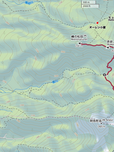
Maps
Trail Description
Day 1
Minotoguchi to Akadake Kosen Hut
Time: 3-4 hrs
Distance: 7km
Elevation change: ➚ 740m gain ➘ 0m loss
From the Minotoguchi bus stop you will need to cross the river and walk along the unpaved road toward the trailhead. You will pass two huts and then cross a stream before reaching a third hut, this is where the trailhead begins and splits into two directions, you'll want to take the one on the left toward Akadake Kosen. From here it will take about 2 hours to reach the Akadake Kosen hut.
Akadake Kosen is where all your options begin, and the trails are well marked and easy to follow with your map. If you base yourself here for two nights you will have a lighter pack for exploring the surrounding peaks, or you can continue on to the other mountains & use the various campsites/huts along the way.
Set up camp here and get ready for the next day, if you have the time and energy I highly recommend hiking up to Mt. Akaiwanoatama (赤岩の頭), it offers a beautiful view and will get you excited for tomorrow. It only takes 2 hours and is a nice ending to your first day. It's an extra elevation gain of 440m and 2km, plus the return back down, you can view the GPS map here.
For extra hiking I recommend including the nearby Oren Lodge into your plans, they have an onsen and an amazing website with great hiking recommendations: www.o-ren.net
Day 2
Return loop of Akadake, Yokodake, and Iodake
Time: 7-8 hrs
Distance: 8.5km
Elevation change: ➚ 900m gain ➘ 900m loss
Today you will do a loop that includes Akadake (赤岳), Yokodake (横岳), and Iodake
(硫黄岳). With optional inclusions of Amidadake (阿弥陀岳)and Minenomatsume (峰の松目), add an extra 3 hours for Amida or an extra 2 hours for Minenomatsume. There is a lot of fun rock climbing and incredible views as you traverse along the ridgeline. You can do this loop in either direction, but I've chosen to start with Akadake because the ascent is a lot more fun, and the descent from Minenomatsume is much easier and possible to do in the dark with a flashlight if you want to watch the sunset. Follow the signs, follow your map, and enjoy the adventure!
Day 3
Option 1: Same trail as day 1, Akadake Kosen to Minotoguchi Bus Stop
Option 2: Akadake Kosen to Mt. Amida to Minotoguchi Bus Stop
Time: 6 hrs
Distance: 8.5km
Elevation change: ➚ 560m gain ➘ 1300m loss
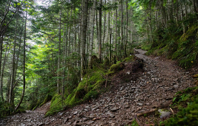
You have some options for returning to the bus stop on your final day. The easiest option is simply to return along the same trail as Day 1, this will take about 2 hours. But if you want more of a challenge and beautiful views, then hike up Amidadake and head down the ridgeline... However, be aware the final climb up Amida can be dangerous if you have a heavy backpack and bad weather conditions, at the time I did this there was an exposed rock climbing section with no chains or rope (possibly broken), and very strong wind, so I only recommend this with favourable weather. It's also worth noting that when I was about halfway down the ridgeline trail, slowly descending in the forest, I encountered a young bear and was briefly chased by a hornet. This trail is an amazing way to end your visit, just be cautious and you'll be okay.

Weather and Seasons
Summer and autumn are the best times for this hike. There is likely to be snow hanging around until May. The autumn leaves will be colourful towards the end of September.
Useful links
Elevation Profile
Day 1: Minotoguchi to Akadake Kosen

Day 2: The Akadake loop

Day 3: Akadake Kosen to Minotoguchi via Amidadake

Cautions
River crossing
Rock climbing
Bears (rare)
Altitude
Gallery

Difficulty: 4/5
Hiking Distance: 24km
Time: 3 Days
Elev. change: ➚ ➘ 2200m
Prefecture: Nagano
Related Articles


