由布岳
Mt. Yufu
Elevation: 1583m
Prefecture
Oita
Distance
8 km
Elevation Gain
900m
Time
5-6 Hours
Difficulty
3/5
Accommodation
Hotels
Overview
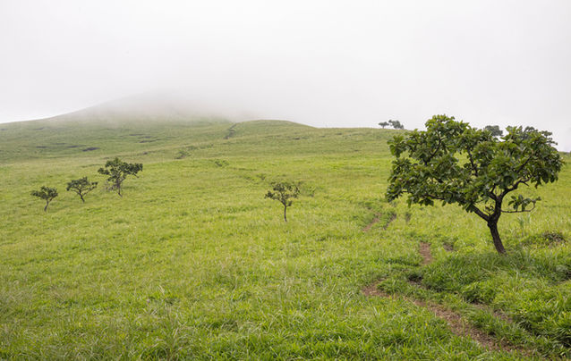
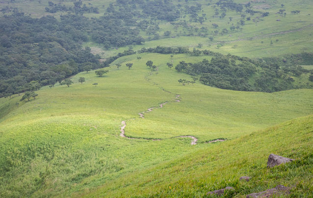
Mt. Yufu is a prominent volcanic mountain rising up above the hot spring town of Yufuin, located next to Beppu, with easy access via public transport. The mountain is stunningly beautiful in summer, with picturesque grasslands, natural forests, and a rocky volcanic crater at the top. The trail meanders smoothly up the grassy mountainside, then into the forest, and finishes with rock climbing along chains and ropes to reach the peak. The views at the top are also spectacular, with a complete panorama that includes the Aso-Kuju mountain range, the ocean, and the mainland of Honshu. Despite the chain assisted rock climbing, it is a relatively easy hike and can be completed in an afternoon. Note that the northern rim of the crater is not usually hiked as it's quite technical and a bit risky, so best suited for those comfortable with unassisted rock climbing.
There are actually 4 trails that lead to Mt. Yufu, the one described here is the most popular because it's easy to access and includes the beautiful grasslands. If you want to do a loop hike, you can include the neighbouring peak of Hyuga-dake, it will only add about 30 mins onto your hike. I have excluded it from this description because I cannot find any nice photos for that trail, so I don't think it's worth it, especially considering the views coming back down can be so rewarding.
Note: When you begin this hike, make sure you take the path on the left that heads towards the grassy peak and not toward the forest, the views and terrain here are amazing and much more unique than the forest trail.
Access
Car: If you're driving, there are plenty of options for parking. The parking at the trailhead might be busy on weekends or public holidays, so start early in the morning or after lunchtime.
Train & Bus - If going by public transport then you'll need to reach Beppu station, from there you can catch a 40min bus which will drop you right at the trailhead. Google Maps includes information for this bus, it's called the no. 36 Yufuin. You can also get there from Kumamoto/Aso/Kuju, just with a tourist info centre for details.
Osaka/Kyoto and Tokyo:
Flights to Beppu can vary a lot depending on the day, ranging from $100 to $200 USD one-way, check Skyscanner for the best options.
The overnight ferry from Osaka to Beppu is possibly the best way to travel to Kyushu. Prices start from ¥8000 and increase if you want a nicer room. The ferry is very nice and an experience in itself. There is also a ferry from Tokyo to Fukuoka. Click here for Osaka, or here for Tokyo.
The overnight bus is the cheapest option, running from Kyoto and Osaka to Fukuoka, Kumamoto, and Beppu, it takes 10 to 12 hours and the price varies from ¥4000 to ¥10,000, with Fukuoka being the cheapest option. Click here for the bus to Fukuoka, here for the bus to Kumamoto, or here for the bus to Beppu.
Maps
GPS map: Outdooractive.com
Useful links
Weather and Seasons
The summer months including June, July, August, and September are the best time for hiking Yufu, the summer will give you a lush green landscape perfect for hiking. It can get pretty warm with temperatures averaging around 32°C. Keep an eye on the forecast for possible typhoons, which peak in August and September. There is also a lot of rain during summer, with June and July receiving the most rainfall.
Autumn provides the most comfortable temperature for hiking, and less rainfall, with the autumn colours reaching their peak around the end of October. Winter hiking is also possible, with snowfall occurring from December to March.

The hike
Trail Description
From the trailhead at the carpark, the trail immediately splits off in two directions. You'll want to stick to the left to ensure you head toward the grassy peak known as Iimorigajo (ee-mo-ree-ga-jo), keep an eye on your GPS map at this point to confirm you're on the right path as it's easy to miss. It will take about 50 mins to reach this peak, after which you head down into the forest and ascend up towards Mt. Yufu. From Iimorigajo to the Yufu crater it will take about 90 mins.
The crater splits off into two directions, the highest peak to the left (west) includes lots of fun chains and rock climbing, the other peak to the right (east) does not have chains but has unobstructed views of Beppu and the ocean. Both of these peaks will take about 20 mins from the intersection. Traversing around the whole crater can also be a lot of fun, but the northern rim is considered risky so only attempt it if you're comfortable rock climbing without chains and make sure you have good weather conditions.
Once you've conquered both peaks, head back down the way you came for more stunning views, especially during the sunset. Another option is to do the loop which includes Hyuga-dake, although this will add an extra 30 mins onto your return and the trail will be mostly surrounded by forest, it also includes some chain sections while descending from the Yufu crater. If you include Hyuga, be sure to let us know what you think in the comments below.
Elevation Profile

Cautions
Altitude & Weather
Rock climbing
Gallery

Difficulty: 3/5
Hiking Distance: 8km
Time: 5-6 hrs
Elevation Gain: 900m
Prefecture: Kyushu
Related Articles


