金勝
The Konze Alps
Elevation: 605m
Prefecture
Shiga
Distance
6.5 km
Elevation Change
➚ 400m ➘ 400m
Time
4 Hours
Difficulty
2/5
Accommodation
Hotels
Overview
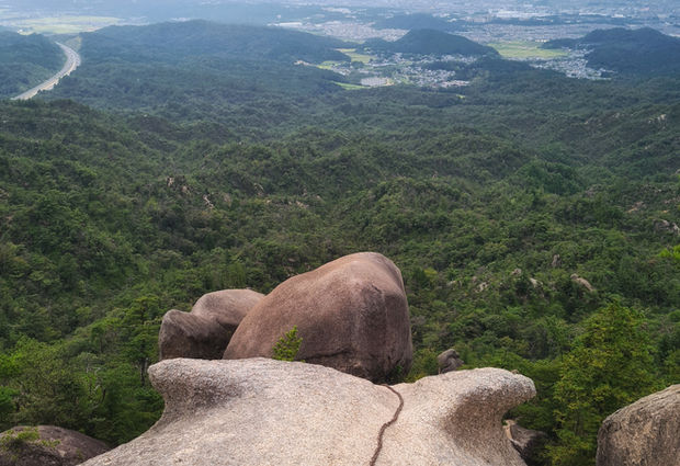
The Konze Alps are a small group of rocky mountains in Shiga prefecture. The loop trail which takes you over these mountains is an easy day hike that offers a variety of terrain, beautiful views, and a nice waterfall. The terrain is unique and features large sandstone formations that are perfect for climbing and scrambling, the sandstone serves as a beautiful contrast with the lush green fauna that covers most of the area. There's a campground at the trailhead in case you want to spend the night. During summer you'll find people swimming in the river and camping along the river banks. It's a super fun hike that stays somewhat under the radar for expats, but it's very popular with locals so the weekends can get very busy, it's well worth a trip from both Kyoto and Osaka.
Access
Car: If you're using a car you can park next to the campground here.
Kyoto: The train to Kusatsu station takes 23 mins from Kyoto station and costs ¥420. From Kusatsu you'll need to catch the 153 bus to the trailhead which will take about 35 mins and costs ¥440.
Osaka: There is a direct train to Kusatsu from Osaka station, it takes about 1 hour and costs ¥1200. From Kusatsu you'll need to catch the 153 bus to the trailhead which will take about 35 mins and costs ¥440.
Note: The final bus back to the station is 7:30pm on weekends and 8:30pm on weekdays.
Trailhead: Google maps
Kusatsu station: Google maps
Note: Although the main trail stays open, some areas are closed in early autumn (Sept. 19 to Nov. 10) to prevent people from stealing matsutake mushrooms.
Maps
GPS map: outdooractive.com
Trail Description
From the bus stop walk towards the campground until you notice a large wooden map of the area. You'll want to walk through the parking lot and up the paved forest road heading towards Mt. Tosaka (鶏冠山) and Tengu-iwa (天狗岩) - use your GPS hiking map to help with any confusion. Keep walking and eventually you'll see a sign reading 落ヶ滝線 1900m 50 分, from here you follow a gravel road that meets up with a small stream which leads up to the mountain. Once you reach the mountain simply keep an eye on your map and enjoy the hike. If you're hiking in September or October be aware of hornets, they are common in this area and are known to be aggressive during these months.
Elevation Profile

Weather and Seasons
Useful links
Spring and summer are the best time for this hike, with the leaves becoming vibrant and green around mid-April. The hornets can be dangerous in September and October. Winter hiking is possible but not advised due to slippery ice frozen on the rocks.
Gallery

Difficulty: 2/5
Hiking Distance: 6.5 km
Time: 4 hours
Elev. gain: 400m
Prefecture: Shiga
Related Articles


